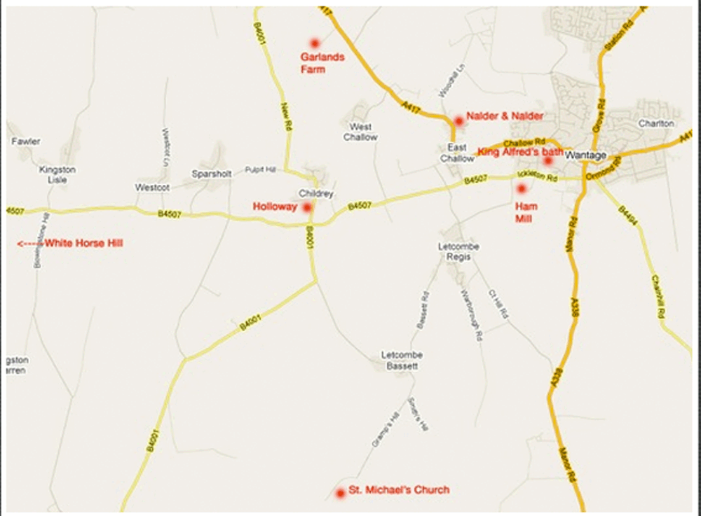
The Geography:…Click here for AREA MAP……or here for tour map
This page takes us on a tour of our ancestral lands in Oxfordshire (formerly Berkshire) and makes no attempt to highlight places of interest beyond those which relate to our family and its branches. However, as you travel, you will pass or come near to a large number of intensely beautiful villages, churches, farm and hill lndscapes and countless historical sights. You should allow at least a full day, but more would be better. If you have extra time, avail yourself of one of the many “circular walks” (country paths) throughout the district. They are clearly signposted and are a wonderful escape from the road. Enjoy! It is adviseable to supplement this amateur tour guide with good maps. The Landranger Ordinance Survey Maps are available at any bookstore in the area. You will need #164 and #174.
Click for details of Venn Mill, for other family mills and for Mill research
The West family as millers go back at least to Daniel & James in the Blewbury, East Hagbourne & Aston Tirrold area. At one point Daniel was at Hine’s Mill in Grove, William Westell West (p4-heretofore referred to as WWW), at Venn Mill, WWW’s brother Daniel at Hanney Mill, and his son Will at Marcham Mill. The same stream (Letcombe or Childrey Brook) runs through all. The road which runs through “West country” between Venn Mill and Wantage/Grove is straight and true, built directly upon what many historians believe was the original Roman Road.
The places are what make our visit so very special. This fact was brought home to me in 1995, back in Victoria, when Connie and I were awakened by a telephone call at 5am. It was David Rogers from the Blewbury Mill wanting to let us know that the Mill was for sale. Lacking the million dollars plus, I politely declined. After you’ve seen it, you might think differently.
STEVENTON
For reasons of driving convenience, the tour begins at Steventon. To reach it from Oxford, take the A34 south past Abingdon and take the Didcot exit, and the Milton interchange toward Harwell & Wantage (A417), and the B4017 north into Steventon. (From Heathrow, take the M4 to the A34 (Newbury /Oxford) exit and go north, taking the Didcot exit. At Steventon town centre, turn hard left, following the signs on the left to the church and “the causeway” . Jog right with the road and crossing the railroad tracks, you will see:
St. Michael & All Angels Church – Steventon The Causeway is a raised, cobbled pathway which runs between two roads from the churchyard to the railroad and beyond. Where you turned off the B4017, on the southeast corner is #1 the Causeway. This is the property, but probably not the house (too new) in which William Westell, daughter Jane, Daniel, and their children lived. The census of 1841 shows William in Steventon with Jane and new husband Daniel, before the birth of their first son Jabez. The census of 1861 shows Jane and her father with Fred at age 16, Mary at 15, Roseamelia at 8 and Daniel at 5. Father Daniel was working at Hine’s Mill (see story of Jane and Daniel), William (WWW) and Fanny were at Lower Grove Mill and presumably Jabez had left home. At this time, they had a domestic servant named Sarah Higgs. Somewhere in the large churchyard are the faded grave markings of William and Jane Westell and William and Christian Westell. Mr. Arthur Bayliss, who lives at The Old Vicarage at #103 the Causeway, has found an old transcription of the grave markings, made by an earlier parson. In the transcription are the names and dates of the Westells as mentioned, but the grave stones before 1880 are generally unreadable. Perhaps someone can find them. They will most certainly be together. If you can’t find them, the 1200 year old yew tree in the churchyard is worth the trip. (The yew tree is a standard feature of churchyards in England, since they live for so long and have poisonous berries to keep the animals away). Mr. Bayliss also has a directory of Steventon which lists William Westell as Saddle and Harness Maker in 1854. Across the railroad tracks on your way back, where the road jogs across the causeway, keep going straight into Stocks Lane. Where that road meets the railway was a plot of land known in the 19th century as Westell’s Close, now a brick ruin & fence. (see above). This was the land of two generations of Westells and where William lived with Jane and Daniel in 1841 before moving to the Causeway by 1861. The land has now been largely usurped by the railroad. At the end of the 19th century, W.W.W., who was the executor of his mother’s will, reportedly had somewhat vexing problems with Great Western Railway (later British Rail) over this land.
Return to the B4017 and go north (left) to Drayton. Turn right at the village green (High Street) and left on Church Lane, just beyond Hall’s Close until you reach (on the left): the Drayton Parish Church. Behind the church, five rows from the far end of the churchyard, one grave over, you will find the grave of William (p5), Grandpa John’s oldest brother, and his wife Eleanor. Note the beautiful specimens of yew tree.
(Click map to enlarge)
BLEWBURY AREA
The six gargantuan water-cooling towers of the Didcot Power station are visible from just about any vantage point in this area. They are coal-fired, not nuclear as they appear.
Return on the same roads through Steventon, but rather than going back on the A34, continue south (right) on the A4130 and east (left) on the A417. Take the first left after you pass over the A34 at West Hagbourne and drive through, following the signs to East Hagbourne. Entering the village you will see the Parish Church on your right. Turn right at the town cross and park in front of the church.
East Hagbourne – St. Andrews Church This is where James (p2) was christened in 1789 and where the family of Daniel and Mary (p1) lived for part of their lives. In addition to the lovely and well kept Parish Church and churchyard, this is one of the most beautiful old tudor and thatch villages I’ve seen in England.
Return to the town cross and continue through the village, and at the next town cross, take the 4016 south (right) toward Blewbury for about a mile.
On your left you will see a sign for West Hagbourne Mill still there but redeveloped. It is famous for the invention of blotting paper. Opposite, there was a a sign for Blewbury Mill. There seems to be nothing left of the latter mill from the closest vantage point I could find without alerting the current owner. Neither of these mills are the historical homes of the Wests, although the existence of either could explain why James West (p2) lived in Aston Tirrold and his father Daniel (p1) in West Hagbourne in the earlier part of their lives. A likely scenario is that at some point in the late 18th century, Daniel (p1) took over the Old Mill in Blewbury, having been at one of the two above mills and his son James worked one of these mills, while living less than a mile away in Aston Tirrold until the death of his father (approximately 1817). By existing footpath the three mills, “Hagbourne”, “Blewbury” and “Old Blewbury” are less than a mile apart.
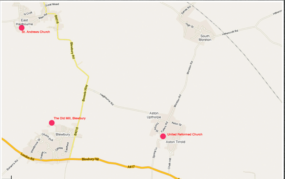
Continuing on the 4016 south to the 417, turn left for 2 k and left again on Spring Lane towards Aston Tirrold. After a hard right and left, you will reach the United Reformed Church on the right.
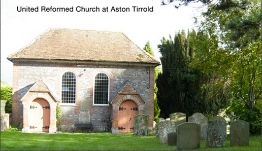 Aston Tirrold is the birthplace of Daniel (p3) in 1813 and where James West’s family lived before moving to live at the old Blewbury Mill after 1817. Nearby St. Michael’s Church was the source of the records (now in Reading and Oxford) which show the baptisms of Daniel and his brother William (who died at the age of 14), but this doesn’t necessarily mean that the Parish Church was the site of his baptism.
Curiously there is another volume of church records available for Aston Tirrold from the Geneology Centre. The burial of one of Daniel’s sisters: Ann in 1817 (probably in infancy) is recorded here. A long tradition of alternative churches to the Church of England in the West family makes it likely that this beautifully restored old brick church housed the congregation to which James and his family belonged.
Return on this road to the A417. At this point you can go right to Blewbury, or if you have lots of time (an extra hour), drive up to visit the village of Aldworth and the historic roots of the Aldworth family: Take the A417 southeast (left) 4 miles to Streatley . As you approach the “T” junction, (white house with bay window) turn right onto A329 and shortly when you see a sign to the left for Goring, turn right just before “the Bull” pub at their carpark sign.
It is a very narrow lane and easily missed, but this is the B4009 to: Aldworth. Gordon Hope paints a fascinating scenario of a tribe of Angles or later Saxons travelling from the flatlands of East Anglia to Stonehenge and encountering the relative safety and beauty of this hilltop location on the downs (hill country), founding the village of “Elleorde”, later Aldworth, prospering in the subsequent centuries and “spreading over much of the County of Berkshire, forming….a solid backbone of yeoman farmers, yeoman farmers, tanners and successful Bristol and London merchantmen.” The parish church is constructed of “flintstone”, fist sized boulders, set in mortar and broken off to expose the black shiny inner material. The church has been refurbished with red brick in places. The main attraction in the church is the “Aldworth Giants”: stone effigies of members of a prominent 14th c. Aldworth family. In the churchyard, there is an ancient yew tree which saw the last millenium, but is looking as if it might not see the next. Elsewhere the small village is constructed of what appears to be the building material of choice in this area of the downs: red brick and flintstone. The trip is well worth it for the excellent panoramic views of the flat lands below. Streatley and Goring are two very pretty towns across the Thames from each other, with locks and dam spillways in between.
Return as you came, proceeding on the A417 into Blewbury. Just before you leave the village, turn right on Westbrook Street. (If you see a sign for Sebastapol Wines, you have gone too far.) At the end of Westbrook street, turn right on Church End; past the Post Office, bear left at the next intersection (Berry Lane), past Millbrook Close on the right and take the next left at the sign on a stone wall which says “the Beeches”. Take the left fork and keep going until the road ends at:
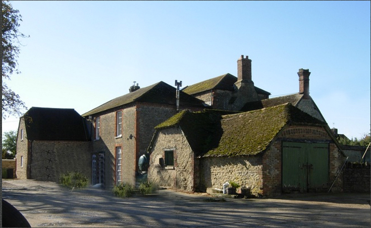
 The Old Blewbury Mill Family history has this as the place of work of millers Daniel West (p1-previously thought to have been named “James”); and James (p2). Family tradition notwithstanding, it is not at all clear how Daniel (p1) could have travelled from East Hagbourne to operate the old Blewbury Mill. More likely he worked for at least part of the time at one of the previously mentioned mills and then at the Old Mill until his death. It is likely that James lived with his family, growing to five children in the cramped quarters of the mill from 1817 until the attached house was built. (see photo, left side) . “Joseph Lousley, the tenant of the Manor, wrote to his landlord in 1824, ‘I have built the House at the Mill.’ Before 1824, the miller had lived in the cramped quarters of the mill itself.”1. This mill is possibly one of the mills listed in the Domesday Book. It was always leased with the Manor until its sale from the Wantage estate (to Henry Prior). The Priors, Henry and son John, were the millers for the later half of the 19th century….Miss Prior, John’s sister, died in 1958, aged 93 years. Mary Irish and Percy visited Miss Prior in the 1950’s and were shown a painting of a woman wearing a Dolly Varden bonnet, probably Susannah Prior. The owner of the mill at this time was Mr. Boumfrey, a well known author and BBC Director. In the 60’s they visited again and the Mill had been converted to three separate dwellings. The previous owner was David Rogers, of the Rogers Sugar family, retired Head of Special Collections Division at the Bodelian Library at Oxford University. The current owners are Helen and Dermot Mathias who have restored it beautifully after many years of occupation by “squatters”. The Mill is in a beautiful setting which is a “must see” on the tour.
Return as you came, to the A 417 and go west (right) a substantial distance to Wantage. As you enter the outskirts of Wantage (on Charlton Road). 100 yards beyond the Lord Nelson Pub on the right hand side. Notice the substantial red brick house at #49, home of Herbert and Doris Smith, built by Herbert “in his spare time”. Continue west on the A417, following the signs to the town centre and market square. Park here.
WANTAGE AREA
(Click map to enlarge)
At the western edge is the Wantage Parish Church. In 1545, Alice Aldworth of West “Hacbourne” left 16 pence for the installation of a “fleur de Lys” decorated bell, which still hangs on the east side of the tower. A later Aldworth grandfather became lost on the Lambourn downs in a fog. When he finally found his way back, he gave money to the Wantage Parish Church to ring a curfew every night at 8pm to guide travellers. Mary Irish remembers the bells playing hymns as a girl, particularly the “Angel’s Hymn”. Indeed, to this day, the playing of this hymn is mentioned in the town’s tourist map. While you are in the square walk down to the right (Mill Street) and see The Baptist Church (also known as Zion Chapel) – built by William Aldworth (b.1818 ), an impressive display of masonry skills and an illustration of his prosperity in the community.
Return to your car and complete the circle around the square, turning right into Newbury St. (A4494 to Newbury), the next left (Ormond St.) and the next right on Chain Hill. Turn right into the cemetery, turn the car around, exit the cemetery and park at the bottom of Chain Hill next to the large brick apartment building, across the street from the bottom end of the cemetery.
Chain Hill Cemetery. Cross the street, enter the lower gate and on the left, 2 rows from the fence, you will find the sandstone, somewhat deteriorated graves of William Aldworth 1871-1909, probably the last son of William Aldworth (b. 1848) and his second wife Mary Ann 1835-1911, who is remembered on the same grave marking. The graves of William and Emma Aldworth (in the older, “non conformist area of the cemetery) are not visible but are probably one of the nearby graves that are weathered beyond readability. In any case, a volume of tombstone inscriptions can be found in the Oxford Library (COS) which confirms their grave in this cemetery.
Return via Ormond St. and straight ahead at the junction with Newbury St. you will see:
The Royal Oak Pub which was run by Charles Collins, a brother of Herbert Collins.
Turn right on Newbury St. and just before the square, note on the right:
The National Westminster Bank, a red-tiled, obviously re-furbished building. This was the house (or its replacement) on Newbury St. in which William and Emma lived until Emma died in 1857.
Turn left into the square, right at the end of the square and left into Mill Street.
The big mill at the bottom of the street is Clark’s Mill. Mary Irish went to Miss Bayley’s School with Freda Clark. (Willoughby’s Mill is in Lock’s Lane).
Continue past the Baptist Church and the Park, up the hill to the double round-about. Note the brick building across the intersection on the left. This is:
The Camel a house now owned by the convent across the street, where William Aldworth and his family moved after the death of Emma. I spoke with a sister from the convent who told me that the order had purchased the property around 1870 (probably from the estate of William).
Continue west toward East Challow on the 417 and drive through East Challow. As you leave East Challow you see on the right:
Nalder & Nalder (now Challow Industries), a large stone building with a fan shaped window over the front door. This is where Percy West (p5) apprenticed to be a pattern maker in the late 19th century and later worked until 1913.
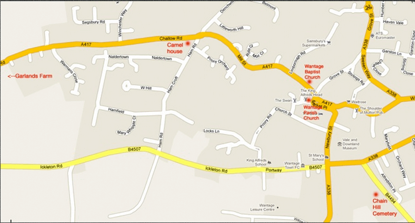
Continue on the 417 past the West Challow exit on your left, past the Denchworth (Circourt Rd.) exit on your right, up a hill, and take the next left before the brick house down a bumpy frost-heaved concrete road. At the end of the drive is:
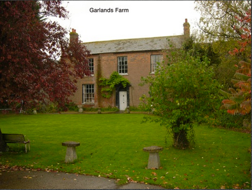 Garlands Farm. This is the farm where family history has it that William Smith, grandfather of Jane Westell lived. Daniel West moved there in later years. It is now owned by his son James’ wife, Brenda West. The house is an impressive two story brick building. Story has it that William Smith’s initials are carved in a table in the house. Unfortunately, the present owners don’t know anything about it. Like all the cousins, Brenda and son Joe West are most delightful and friendly people.
Continue on the 417 (Faringdon Rd.) and turn left and south on B 4001 (New Rd.) through Childrey. As you leave town up a hill, you will notice the rather deep treed trench which the road occupies as it approaches the B4507. This is:
Childrey Holloway, where an Aldworth ancestor was murdered by highwaymen in the 17th century while returning to Wantage after buying a horse at an auction.
At this point, if you have a full day or more, you might wish to travel the road on which the Venn Mill family took a once-a-year outing in a horse drawn trap to White Horse Hill. If so, turn right on the B4507 for about 3.5 kilometers and turn right through Kingston Lisle. Three kilometers further, towards Baulking, just before the railroad tracks, you will come to Hale’s Farm. (If you don’t have the time, skip over Hale’s farm and White Horse hill to the directions to Letcombe Basset.)
(Click map to enlarge)
Hale’s Farm – During one of the family outings, the horse was tied up at the bottom of White Horse Hill while the family went to the top. Upon their return the trap was there, but the horse was gone. Everyone spread out to look for the horse and Fred came the amazing distance to this farm (10 miles?) to find help. After a few hours, the horse was found near the bottom of the hill, but Fred was lost. Later he showed up with a Mr. Partridge and another horse.
Return to the 4507 and continure to the car park for:
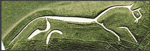 White Horse Hill – This is a must-see in any case, but all the more enjoyable, imagining such a family outing 100 years ago. The historical markers give lots of information.
If you have skipped the last two attractions, continue on the 4001 from Childrey across the B4507 toward Letcombe Bassett.) Returning from the White Horse Hill on the B4507, turn right on the B 4001 until you come toward Letcombe Basset. When the 4001 bears to the right in town, continue right at appropriately-named “Gramp’s Hill” (sign to Downs Church) Up the hill, bearing right, you will see on the left:
St. Michael’s Church and Churchyard (Forster Lane – park here) There is a volume of tombstone inscriptions of this churchyard which shows that this is the burial place of Thomas Newton. The exterior of the church is not restored but the inside is very nice. This is also a
particularly lovely village and churchyard. As you leave the village, note the picturesque branch of the Letcombe Brook which powered all of the “West” mills further downstream.
Go back to the main road and turn right toward Letcombe Regis. There will be lots of twists and turns but follow the signs to Letcombe Regis and after that, to Wantage. When you arrive back at the T junction which is the B417, turn right and take the next right on Ham Rd.
The fork to the right will take you to the beautiful manor called The Ham, or go straight ahead and on the left is the Ham Mill, another restored building in an equally beautiful setting, where W.W.W. and Sarah (b. 1845) lived after their wedding in 1868 until after the birth of first son Will (1869).
Return on Ham road across the A417.
A short distance along Ham Road on the left is a fresh water spring which both Sarah Aldworth and Doris Smith remember drinking from on a hot day as children. By a spring and the brook, near the corner of Lock’s Lane is the location of King Alfred’s Bath, an ancient brick work. The area north and east (where “Wantage” is printed on the area map) is called “the mead” and is the reputed site of King Alfred’s birth. (I heard of the sites described in this paragraph from Mary Irish after I left England, so have not seen them personally. You could be the first!)
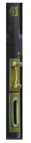 Continue on Ham Road north to the double roundabout (Camel House corner), turn right on Mill Street (town centre) and just before the town square, turn left on Grove Street (Midland Bank). Where the road turns to the right and on the left side is:#41, Grove Street The pattern for the brass knocker was made by Percy West. Since this is a dead-end street, return to the square, turn left and proceed more-or-less straight on to the roundabout. Turn north (left) on the A338 toward:
GROVE
 On the left and right (past Mably way on the left) , notice Elms Farm and a new housing development called Elms Farm Close) where Herbert Collins (b. 1849) and his family lived. This was the centre of the Smith’s large dairy farm.
Take the first left to Grove (Main St.) Continue a very short way down Main St. The next left, just before the gas station, is Mill Lane.
Hine’s Mill The row house directly in front of you, is where Daniel and Jane West lived until they died in the 1880’s. At the end of the road is beautifully restored Hine’s Mill, where Daniel worked. Gordon and Joyce Entwhistle are the current delightful owners. They are real “Mill Buffs” and well worth meeting.
The next left up Main street is Cane Lane. The third cottage on the right is Venbrook, (named by Mary Irish), the cottage where Percy lived with his second wife Miriam until their deaths in 1975 and 1989.
(Click map to enlarge)
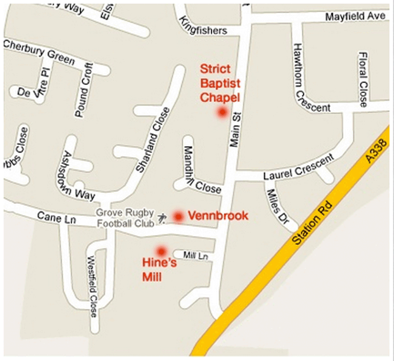 Continuing up Main Street, you will pass Mandhill close on the left and an equal distance further will bring you to a black iron fence on left.
This is the Strict Baptist Chapel and Churchyard. For me, it is the most impressive sight, since it holds the quite readable grave marking of at least three generations of Daniel’s (b. 1720) descendants. Much of the history of this congregation is the history of this branch of the Wests and Aldworths. The grave stones you will find are: Daniel (b. 1813) and Jane, Daniel (B. 1856) and Catherine, Roseamelia and Martin Shepherd (B. 1841), Harriet and Herbert Collins (B. 1849), Miriam and John Smith, Mercy Smith (B. 1857), Lydia Smith, John and Miriam Collins, Joseph and Eunice CollinS, Ann Collins, Stanley Pinnell, Percy West and Miriam, Ruth Collins SmitH, Arthur and Daisy Smith, Billy and Joan Smith, Herbert and Doris Smith, Harry PococK and James West (B. 1856), Mr. Tugwell, a Deacon of this congregation, was a good friend of Percy West and has many stories to tell about Percy and the congregation. He also seems to know a fair amount about the West family.
Contiinue upMain Street, turning right at the next roundabout (Oxford St.) to the A338, and go north (left) toward East Hanney. Don’t take the first road to West Hanney, take the second left (blind corner). Stay all the way left & the first building on the right will be a: white building which was the bakery and house of Philip and Harriet Long, and the birthplace of Grandma and Uncle Jack. Turn around and take the village road left, past the red phone box turning left on Halls Lane. Follow the road left and then right. At the end of the road take the left fork and you will come to:
(Click map to enlarge)
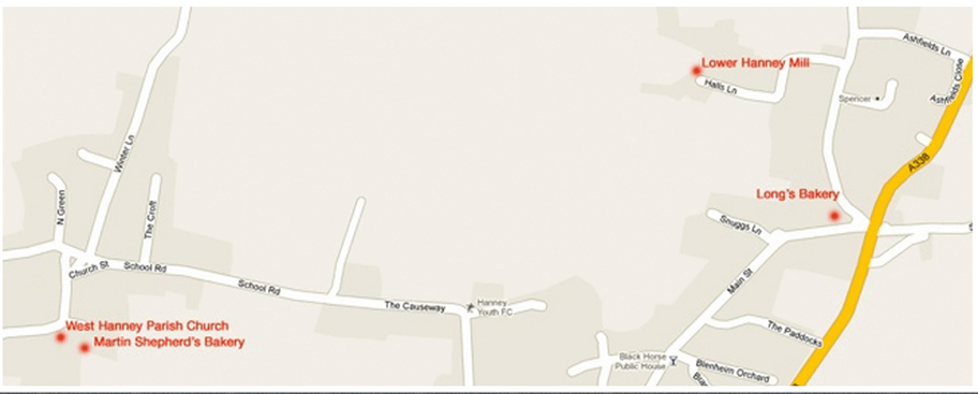 the Lower Hanney Mill where Daniel West worked for a time and later his son Daniel. Jack Ireson remembers a sign on the mill saying WEST’s MILL although it is likely that this was removed in recent years by some history buff. (Well, really!!!) It is a tall thin building; quite
 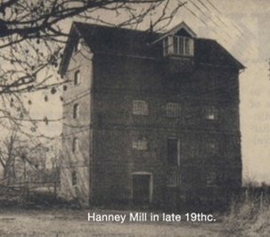 unusual, now a residence – the nearby Mill Cottage is also occupied. Nigel Hammond in his book: White Horse Country (Blackwell, Oxford, 1972) refers to this mill as “West’s Mill” (pg. 105). Kelly’s Trade Directory for Berkshire shows a West (no initial) at Lower Mill, East Hanney in 1868 and Daniel (W.W.W.’s) brother at the same mill in 1869,77,83,87,91,95,99 & 1903. In the early century, Jack’s father Allan Ireson was a landowner who owned Morlands farm which you pass on your way to the mill.
Return to the Long’s bakery and continue down that street, following the signs to West Hanney. At the town cross, turn left, go past the manor house on the right and straight ahead is:
The West Hanney Parish Church. Prominently placed near the front door of the church are the graves of Philip and Harriet Long. To the left of the Church (as you come down the road) is a stone building which was Martin Shepherd’s bakery. To the right is Prior’s Court. An Aldworth relative (?) “William Aldworth took leases on this property in 1840,47,54 & 61. In 1847, New College Oxford (the manor having been granted to them by Henry VI), obtained a valuation (an inventory describing rather large and elaborate house and farm estate. Elsewhere in Hanney, there was a house and farm called ‘Aldworth’s’.
Return to the A338 and continue north to:
(Click map to enlarge)

Venn Mill (You can’t miss it, and in fact if you don’t slow down, you’ll hit it!) It is thought that the name Venn (spelled Ven in 19th century documents) evolved from Fenn, meaning marshland. Very early documents refer to Fenn Mill. According to the Domesday Book, there was a mill here in 1086. The mill house dates to the 17th century. Recent excavations have uncovered foundations of the earlier house adjoining the mill itself. Kelly’s Trade Directory for Berkshire shows W.W. West at Venn Mill in 1903 and J. West in 1907. William Westell West and Sarah came here first in 1870. The census of 1871 shows W.W.W., Sarah, William, age 1, John Aldworth, (brother of Sarah) at 15 and a domestic servant named Harriet at the Mill house. All the children except for Will were born here as well as Grandpa John and Emma’s second born: Elsie. The census of 1881 shows W.W.W., Sarah, (Will was at Hine’s Mill with Grandpa Daniel), Emma at 9, Asher at 7, Fred at 6, Percy at 3 and Elsie at 1. All the children of W.W.W. and Sarah went to Garford School, which was one mile north. They were taught by Mr. Neville (probably the father-in-law of George Long) and later by Mr. & Mrs. Harris, who particularly liked the Venn Mill children (well disciplined and intelligent). W.W.W. was a visiting inspector of the school, who checked and signed the registers. Betsy Fox was the itinerant nurse who came once a month and when the new babies came. By the 1891 census (the Grove report was in William Westell West’s handwriting and signed by him), Will, Emma and Asher had left , Fred was 16, Percy 13, Elsie 11, John (Grandpa) 9, Mary 6, Heber 4 and Ruth 6 months with no domestic servant in residence. The family shared in the many tasks around the house and mill, baking the bread, making clothes for all the children and brewing the beer, (apparently an acceptable beverage to the Strict Baptist, as opposed to gin) . The nearest town was five miles away in Wantage and the nearest shop one mile away in Garford. The mill complex included meadow lands in which hay was grown. The family had two cows. See also “the lost apples” story. In 1993, the owner of Venn Mill (not house) was Alan Stoyel, a geologist, who has restored the mill to operating status. It is a “breastshot wheel”- see diagram. On a Sunday, once a month, June through October, he opens and operates the mill for tourists, grinding flour for the ob-servers. To see, hear and feel the Mill in operation is a memorable experience. (click for Venn Mill page)
THE LOST APPLES:
Another family story tells of the apples which were brought into the mill house and somehow misplaced. The family could smell them but could never find them, even when they rotted!
North again on the A338, the building on the left is the Old Schoolhouse, now three dwellings. The next sharp left will take you into:
GARFORD
As you enter Garford, there is a manor farm (now H. Walker and Son) with large stone barns directly ahead of you. This was the home and livelihood of Mr. & Mrs. William Long (Philip’s brother) Described as a horse and trap Manor Farm, it was one mile walk from Venn Mill over the fields. It was here on Queen Victoria’s Jubilee in June of 1877 where Mr. Long cleared out a barn and a nearby meadow for a lavish dinner (lots of beer, which Percy remembers “suited some and not others”) and a day of games and merriment. Stop here and walk between the Manor House and the barn and you will come to the St. Luke’s Chapel. There is a huge key to the church: as you enter the yard, on the right side of the door of the house, (knock first) on a hook behind a vine. The tiny church houses a grand piano an electric organ and a pump organ. There are short pews in the front, seemingly for choir boys or children. In the Churchyard, in the far right-hand corner away from the church, you will find the graves of Philip Long, William and Eliza Long, and daughter Mary Eliza in addition to the graves of Peter and Emma Hatton. Continuing down the road through the village, you will come to the town hall, a curiously out-of-place wood-frame building and the next building opposite on the right, now called “sundial cottage” was Peter Hatton’s shop – the closest store to Venn Mill. Percy said whenever they had a ha’penny to spend, he went to Mr. Hatton’s shop to buy sweets. Hatton used to chase them because they would taunt him: “Peter Hatton, Peter Hatton had a pig and couldn’t fatten’m.” Mr. Powell was a well-to-do man in the village. His son Claude went to the very upper class “Abingdon School”. Claude came home and told many exaggerated stories and the boys (and Peter Hatton) laughed at him, getting them in much trouble with the wealthy Mr. Powell.
An alternate and much more “atmospheric” approach to Garford, is to follow the route used by decades of our ancestors. Take the footpath which angles off to the left just north of Venn Mill and intersects with the incredibly narrow road to Garford. Walk all the way through the village toward distant farm buildings and turn left before the buildings on the footpath which goes by an “oasis” of trees (the bronze-age burial mound) and intersects with the original path. Turn right to return to your starting point.
Leaving Garford, (or Venn Mill) go north on the A338 again and take the right on A 415 to Marcham. At the town centre, turn right (south) on Mill Road (sign to Manor Farm) and go to the end of the road. You will find:
 Marcham Mill, where Grandpa John’s brother Will lived and worked. Since the census of 1881 puts him with Daniel and Jane (at Hine’s Mill (apprenticing), and we know he visited Canada in the mid 1880s, we can estimate that he lived at Marcham Mill from some time in the 1890’s. Letters in the Berkshire Record Office document an Offer of Tenancy by the owner of Marcham Mill, subsequently guaranteed by W.W.W. in 1901. Another offer by the landlord to Will, and Will’s letter of acceptance of 1909 is also there.
ABINGDON
Continuing east (right) on A 415 (to Dorchester), go through Abingdon. On the left 1-2 blocks, after the clock tower until just before the bridge, turn left and park. At the end of that lane, near the “Unicorn Theatre” sign, you will find a very narrow passage up a stairway to your left. Up the stairs and across a parking lot slightly to your right is a non-descript cement block building which is:
Abbey Baptist Chapel (1832) – This is the chapel where Jane Westell and Daniel West met (previous anecdote) and where William Westell West was baptised. In the years after 1830, a very popular minister, Mr. William Tiptaft, attracted great numbers of people from a large surrounding area to his Sunday sermons. This could explain why William Westell and his family would come all the way from Steventon by horse and trap to attend services. Nearby is a pub which amusingly is the only place church-goers could “park” their horse and trap; the same was true in Grove. Billy Smith and his family still come from Grove and are a back-bone of the present congregation. The Chapel was externally renovated in the 1950s, but it is the original building.
Thus ends our tour. There are far too few Wests in England now, so I’m not going to tell you how to get out of here!! Actually, before you leave England, be sure to take another day to drive to:
OPTIONAL TRIPS
Stowford, Trowbridge
Take the a338 south to the M4, go east into Wiltshire and south on the A350, and Bath Rd./A4 to Corsham. Then take Bradford Rd./B3109 and Frome Rd. to Stowford.
The impressive manor farm and mill of two generations of Bryants. In 1969, Jack and Phil Bryant took me to Farleigh’s Pub at the Farleigh Castle Ruin just up the road, another fascinating place (the ruin, that is). Stowford is now owned and operated by Phil Bryant (junior). The run a B&B and caravan park here. Check their website at: http://www.stowfordmanorfarm.co.uk/
Heathfield, Sussex
Take the M4, west to the M25 (London Orbital), south and east to exit 5 and south on the A21 and B265.
Here you will find Steventon, Broak Oak, the house where Auntie Ruth and John Cook lived and Laurel House (just up the street) where William Westell West and Sarah lived after Venn Mill, and the Ebeneezer Strict Baptist Chapel where W.W.W. preached and is buried, along with Sarah and the four daughters.
————————